LESTERDIRECT
Bringing civil-grade precision, 3D topographical mapping, and technical site preparation to residential & commercial sites across Volusia County & Central Florida...
Stop paying for the "guess and bulldoze" method.
Navigating local building codes and setbacks so you can build with confidence.
The Cost of Guessing: Buying a metal building, pole barn, or carport online is easy, but discovering that your planned site violates local setbacks or zoning rules after delivery is a financial nightmare.
The Precision Solution: We act as your Technical Site Assistant. We determine your zoning setbacks, calculate maximum impervious area limits, and prepare the professional site plan drawings you need to submit to the county. We translate complex municipal requirements into clear, step-by-step guidance, giving your owner-submitted application the absolute best chance of a first-pass approval.
Key Deliverables:
The Assessment: We build your project on a screen before we move any dirt.
The Cost of Guessing: Hiring a standard tractor operator who "eyeballs" the grade often results in placing your new building in a flood zone or a topographic low spot, costing you thousands in structural fill to fix later.
The Precision Solution: Using advanced digital measurement sensors, we perform a detailed topographic terrain scan of your site. We establish an optimized Finished Floor Elevation (FFE) benchmark to minimize your need for expensive import fill before your building is even ordered.
Key Deliverables:
The Plan: Clear, trade-specific plans that protect your budget.
The Cost of Guessing: Handing a confusing 40-page manufacturer assembly manual to local crews leaves too much room for structural layout mistakes, out-of-square concrete, and framing clashes.
The Precision Solution: We translate complex factory blueprints into a simplified Computer-Aided Design (CAD) site plan and a clear, trade-specific Scope of Work (SOW). We establish coordinate boundaries, exact foundation dimensions, and map out essential electrical drops and ventilation rough openings (ROs), giving you the exact documents needed to secure accurate quotes from manufacturers and contractors before ground is broken.
Key Deliverables:
The Execution: Laser-guided, rock-solid subgrades that guarantee your concrete budget.
The Cost of Guessing: A foundation pad that is just 2 inches out of level across a 40x60 footprint wastes over 15 cubic yards of concrete. At $227/yard, that’s $3,400 of your budget destroyed on pour day.
The Precision Solution: We utilize dual-axis rotary laser grading and high-frequency vibratory compaction to physically build your pad to within +/- 0.5-inch tolerances. We guarantee your concrete yield and provide a zero-tolerance blueprint for your installation crews.
Key Deliverables:
The Fix: Forensic topographic analysis and turnkey project recovery.
The Cost of Guessing: You hired a traditional operator using "eyeball" grading methods. Now, your building pad has failed county inspection, your active construction site is flooding, or your concrete crew has walked off the job because the footprint is completely out of square.
The Precision Solution: When a project is failing, visual estimates are useless. We perform a forensic topographic scan of the failed site to mathematically evaluate what is on the ground versus what your building manufacturer actually requires. We deliver a clear root-cause analysis and execute surgical material extractions to rebuild your pad to absolute municipal compliance.
Key Deliverables:
The Access: Heavy-duty roadway and drainage solutions built to last.
The Cost of Guessing: The "Bathtub Effect." When an operator just "dumps and runs" asphalt millings or gravel, rainwater pools on the loose, uncompacted surface, rapidly creating washboards, deep ruts, and washed-out aggregate.
The Precision Solution: We treat roadways and driveways as structural civil access channels. We grade precise lateral cross-slopes to shed surface water, stabilize the sub-base with compacted aggregate or screenings, and deploy heavy high-amplitude vibratory rollers to bind the material into a solid, asphalt-like driving surface. We pair this with precision-cut, mowable parabolic swales to guide pasture and site runoff safely away from your driving corridors.
Key Deliverables:
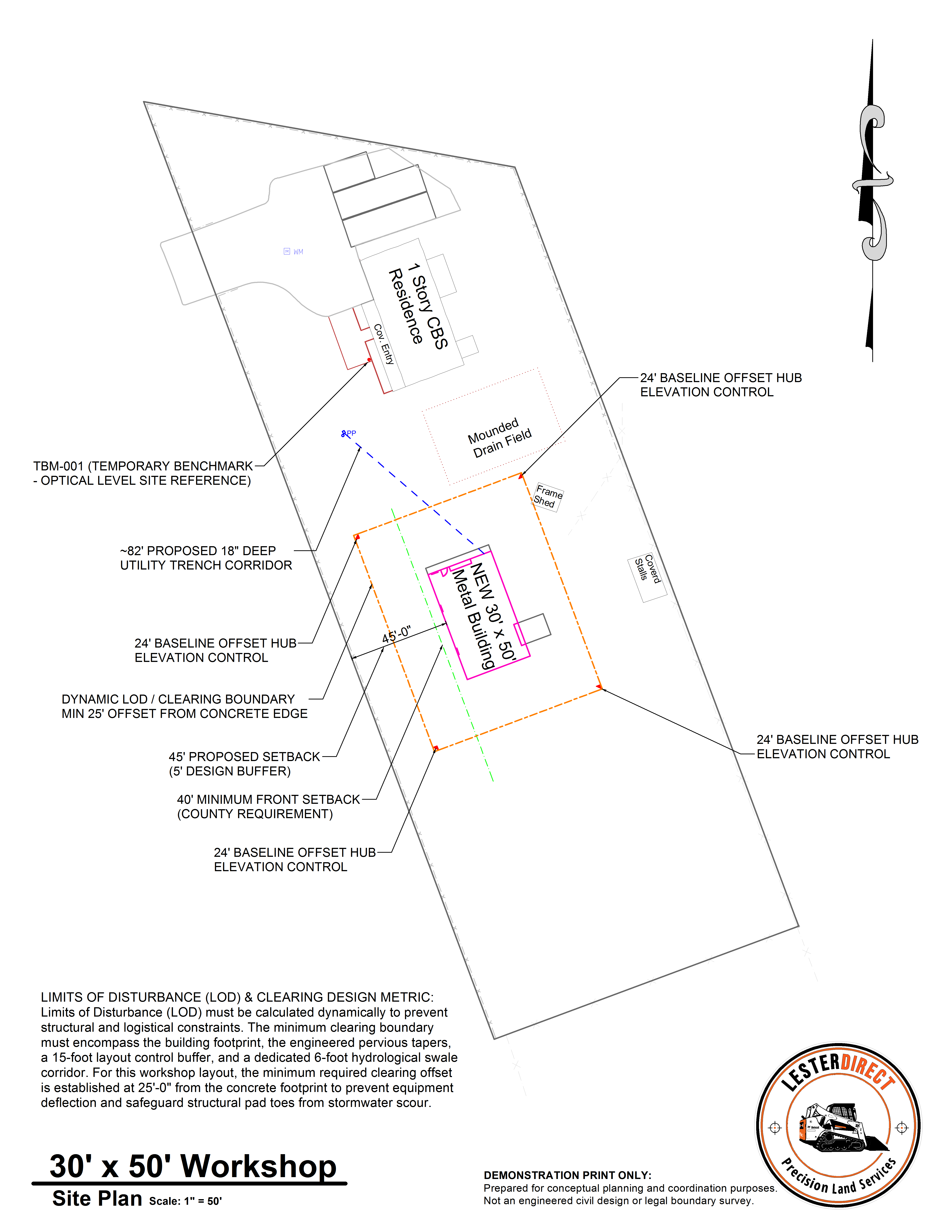
We don't guess. We digitally model your entire property envelope—coordinating structural setbacks, plotting utility conduits, and establishing physical benchmarks alongside our 24-foot coordinate recovery hubs safely inside a dynamic 25-foot Limits of Disturbance (LOD) clearing boundary.
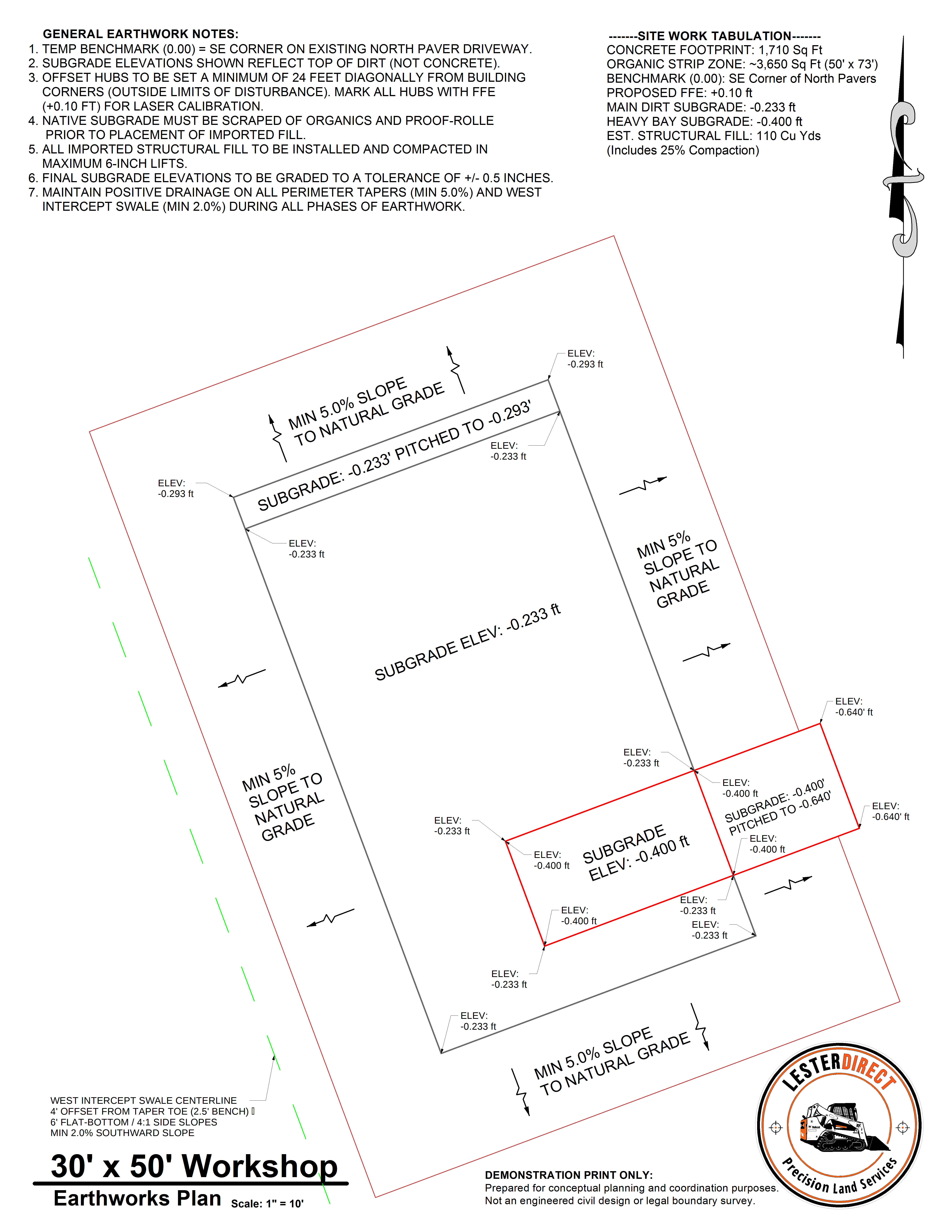
Precision-built to protect your concrete budget. This high-detail layout displays our zero-tolerance, dual-plane subgrade elevations (-0.233' Main Pad and -0.400' Heavy Bay), 5% compacted sand-clay tapers, and the precise geometry of our 6-foot flat-bottom West Intercept Swale.
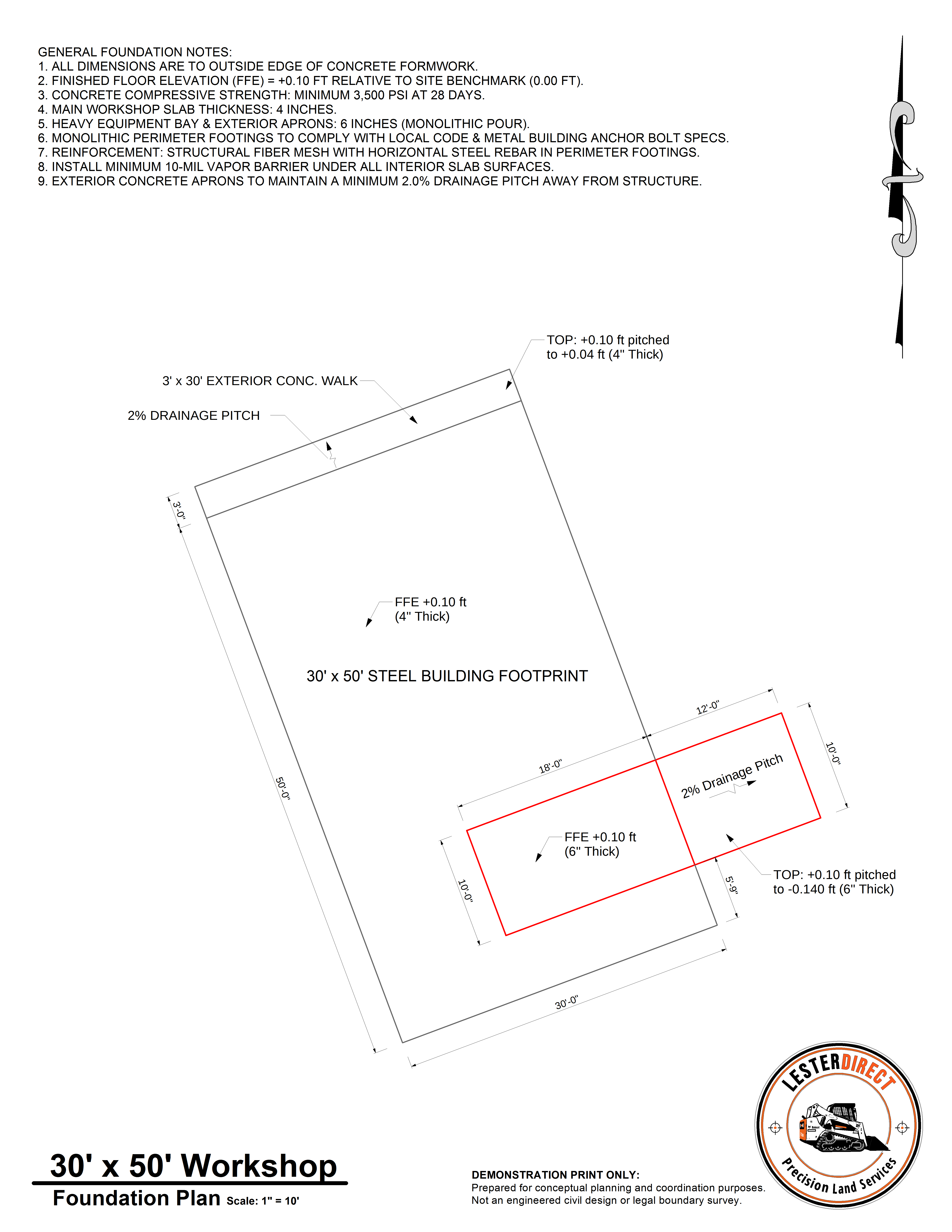
We translate building footprint requirements into a precise execution plan. This sheet establishes exact outer slab dimensions, perimeter edge lines, and 4-pin coordinate stakeout locations. By locking the subgrade to within +/- 0.25 inches before formwork is set, we eliminate subgrade high/low spots and protect concrete yield on pour day.
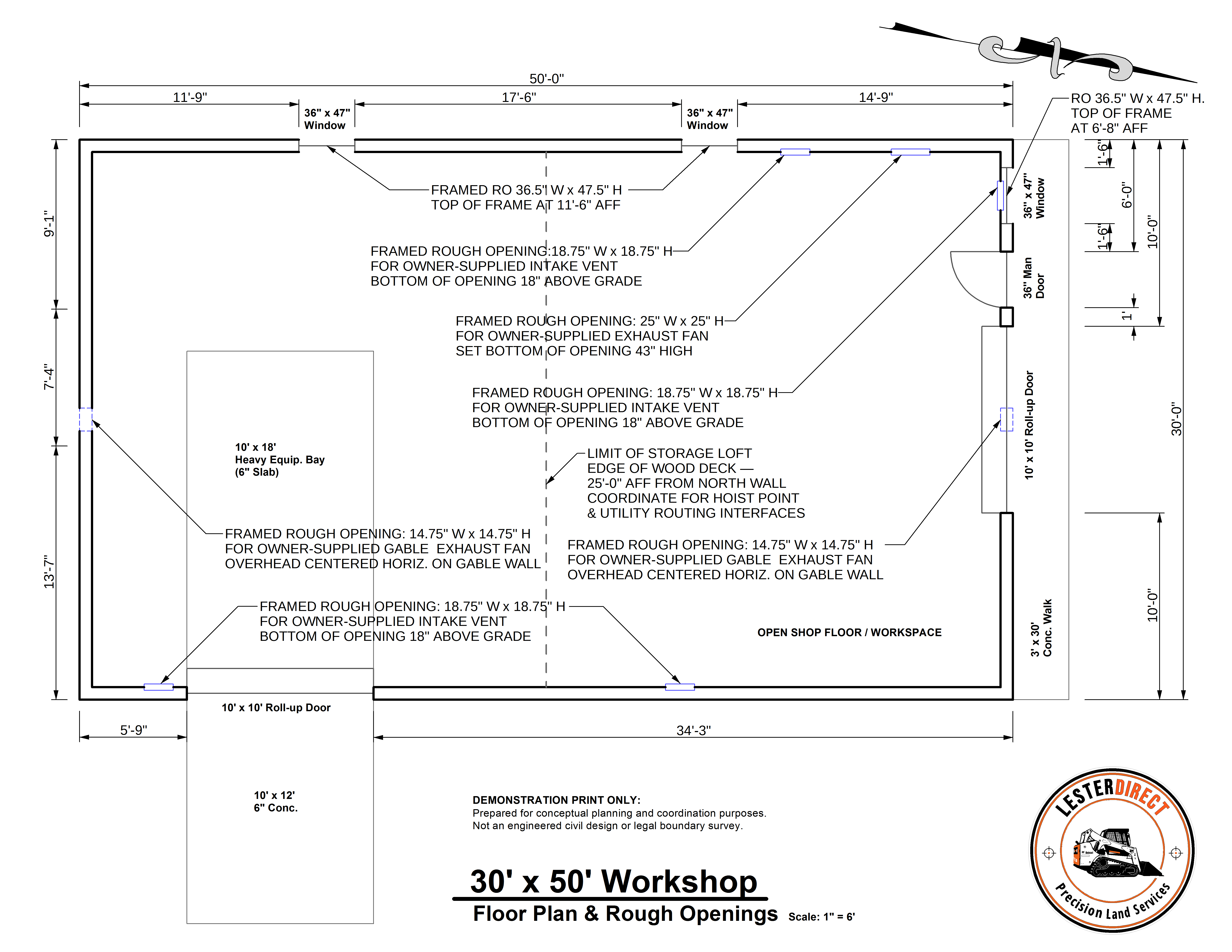
Before structural elements are set or slab concrete is poured, we map out the internal spatial layout of your facility. This plan coordinates building perimeter walls, equipment clearance zones, utility stub-out locations, and exact Rough Openings (R.O.) for personnel doors, roll-up bay doors, and ventilation louvers. Pre-verifying these dimensions ensures seamlessly integrated access and zero structural rework.
Slide or click between project milestones to verify subgrade transformation from raw ground to laser-graded precision.
Capturing raw site clearing, full organic stump extraction, subgrade leveling, and 4"–5" clay-sand lifts compacted at a 1.0% shedding slope to prevent water pooling and protect subgrade density.
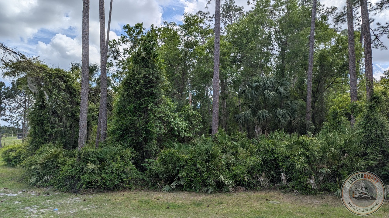
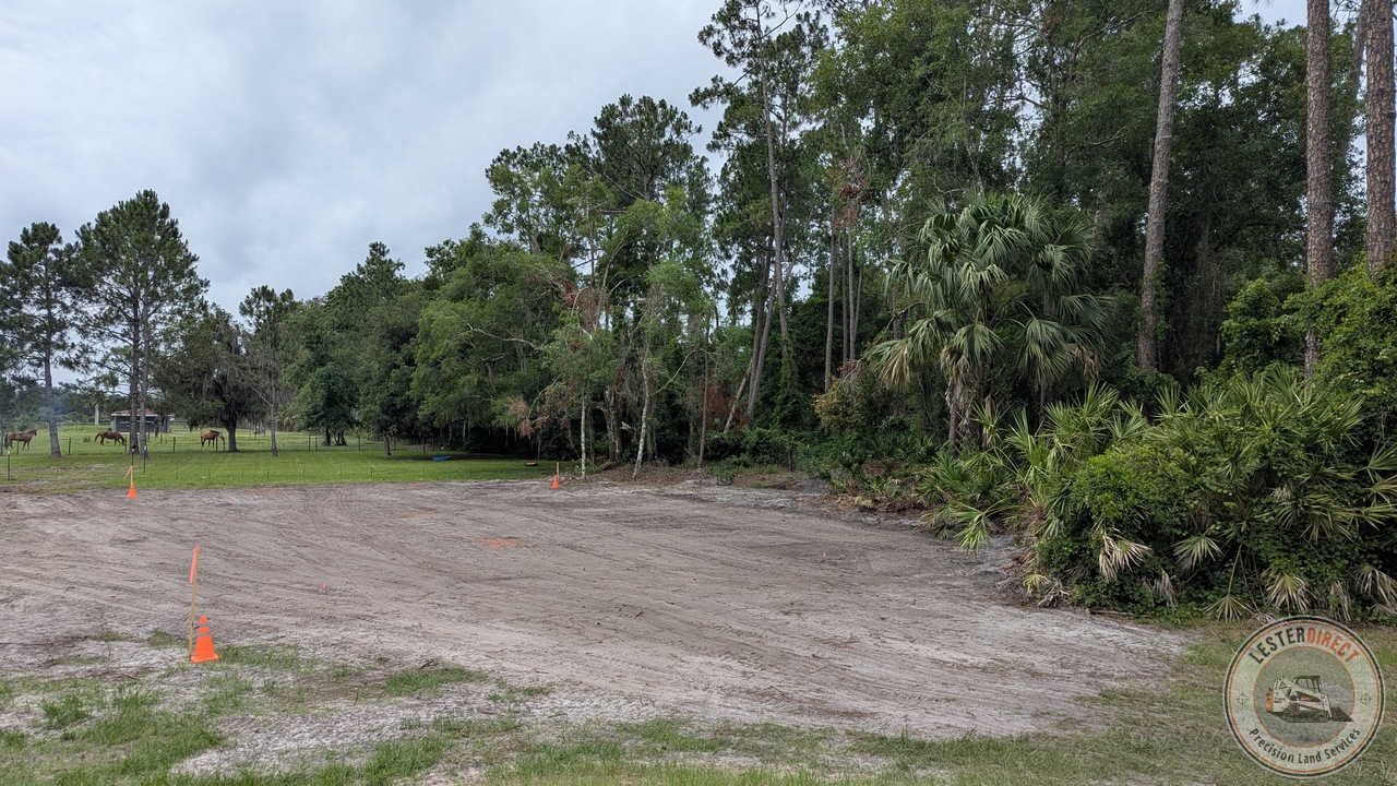
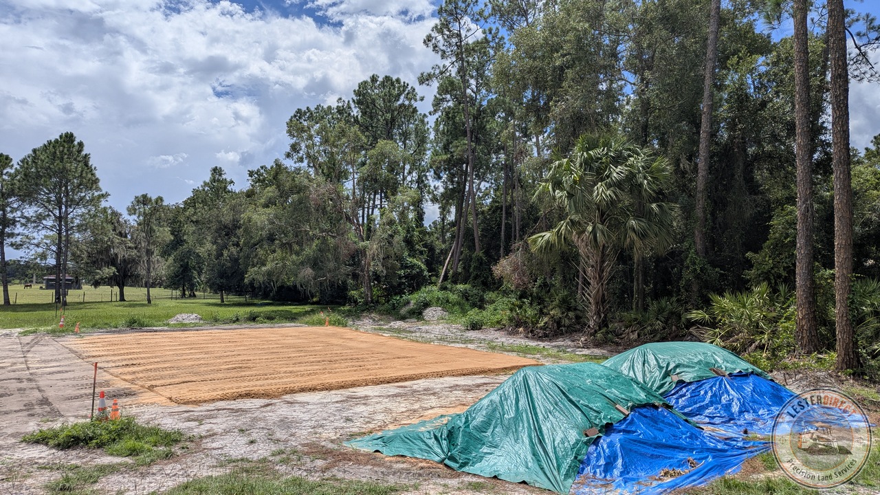
3-stage progression illustrating initial clearing, complete subgrade grubbing, and laser-guided placement of 4"–5" structural lifts with a 1.0% water-shedding pitch.
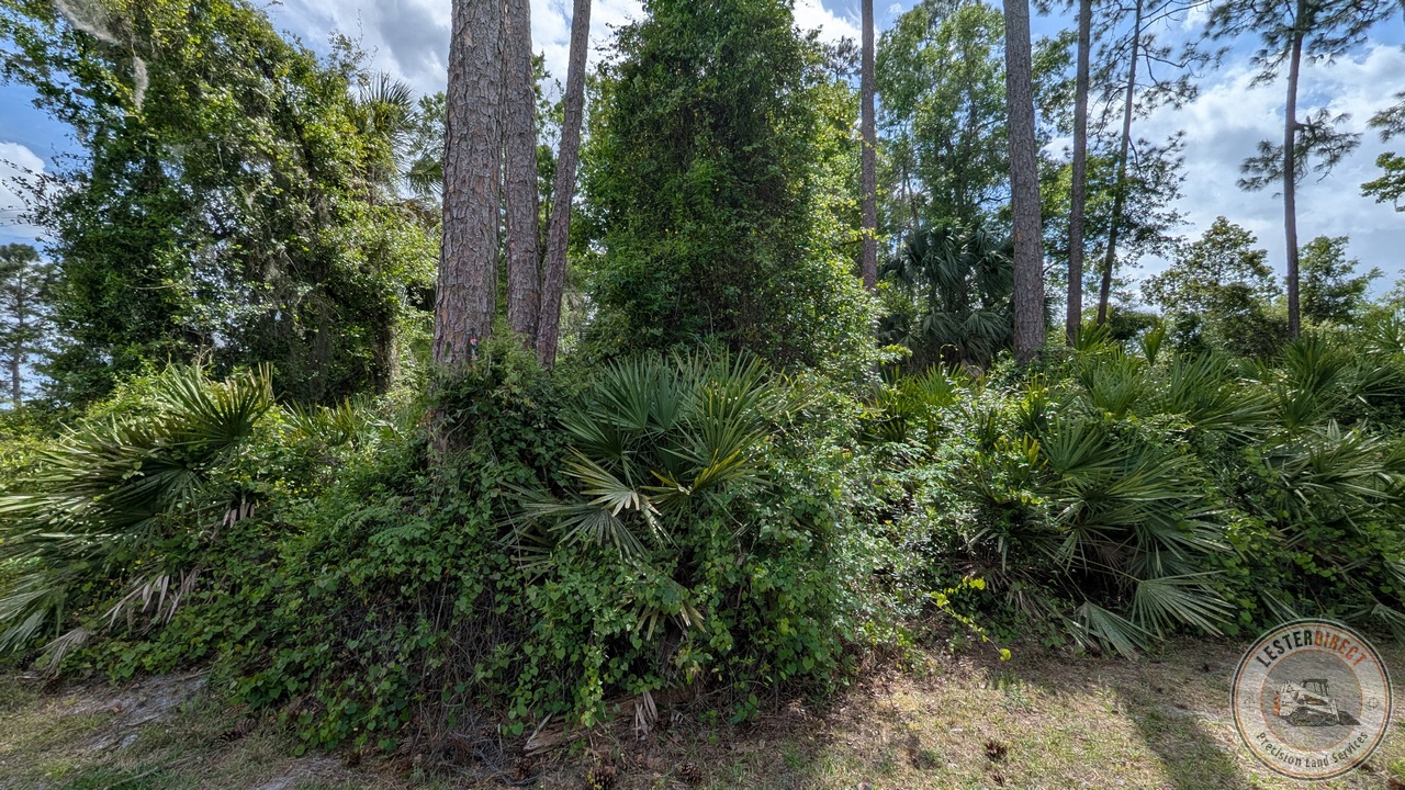
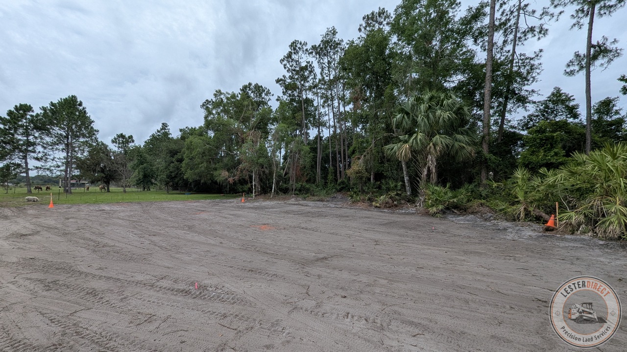
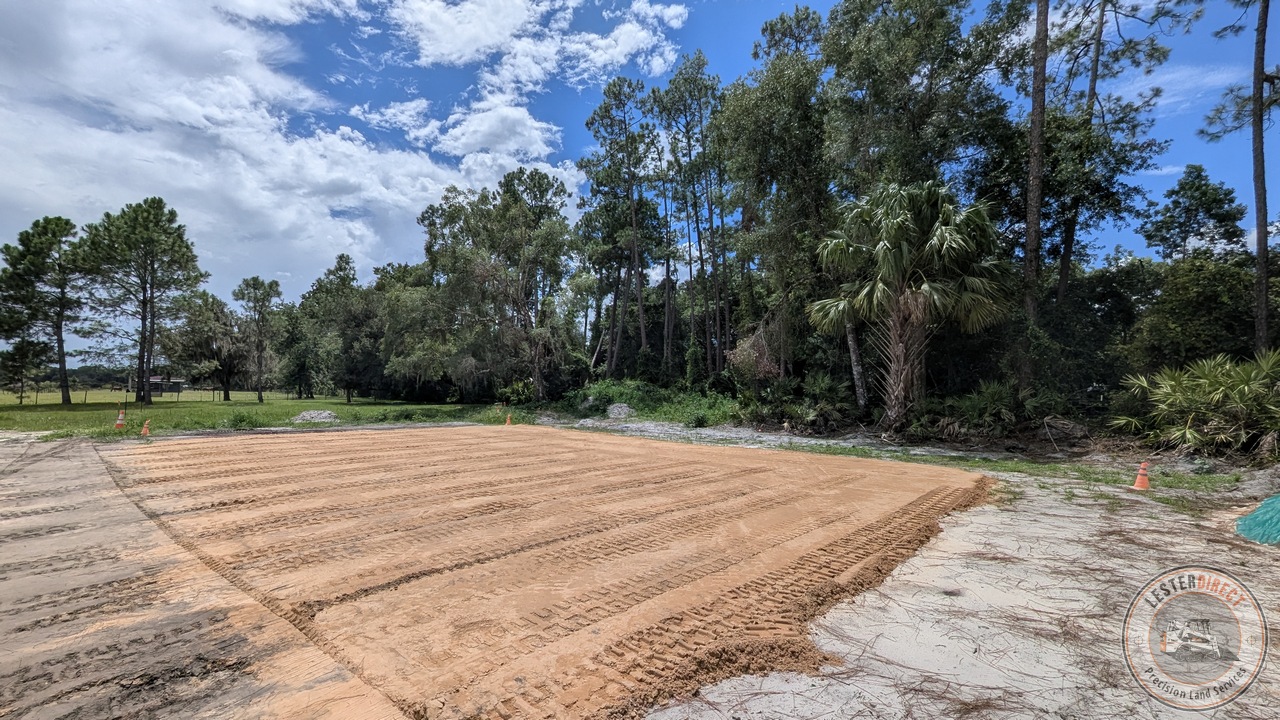
Demonstrating native pasture clearing, complete root and stump excavation, and compacted 4"–5" lifts sloped at 1.0% to sheet precipitation directly into perimeter swales.
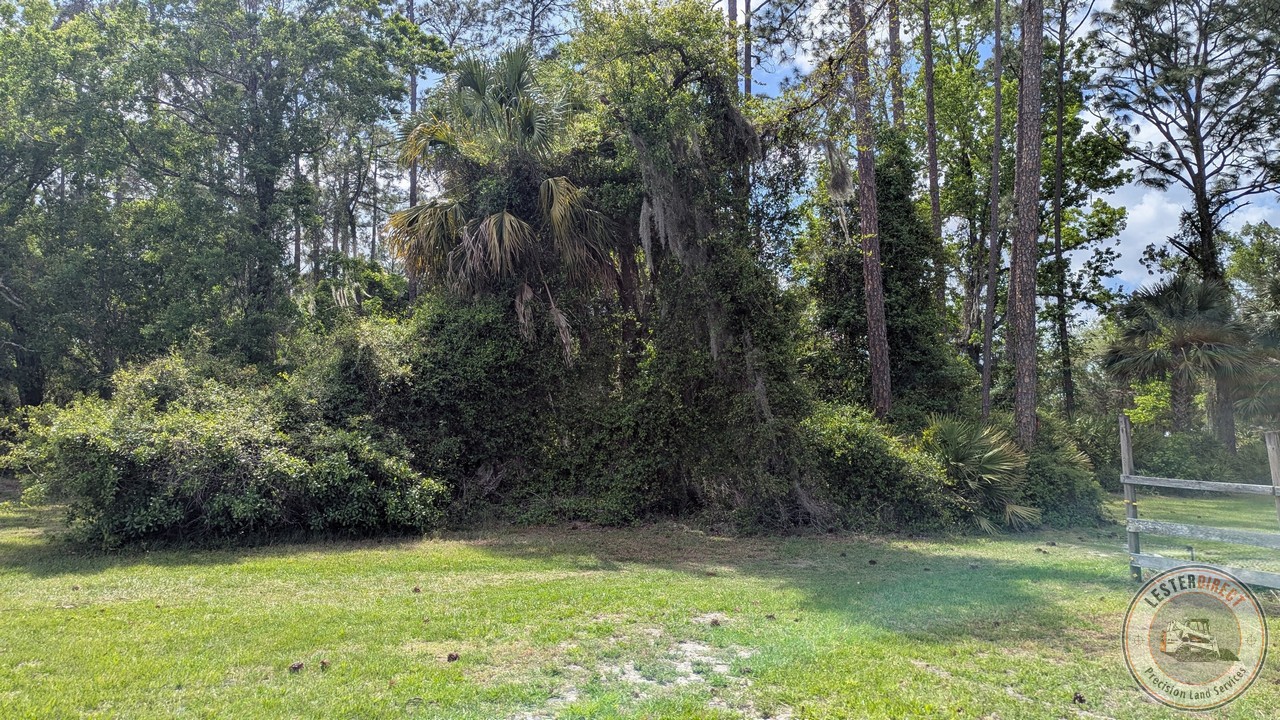
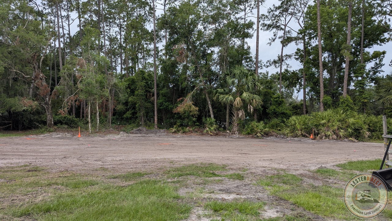
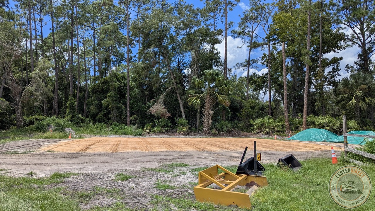
Macro perspective showing raw pasture clearing, native soil stripping and organic grubbing, and active 4"–5" clay-sand lift compaction sloped at 1.0% to defend subgrade integrity.

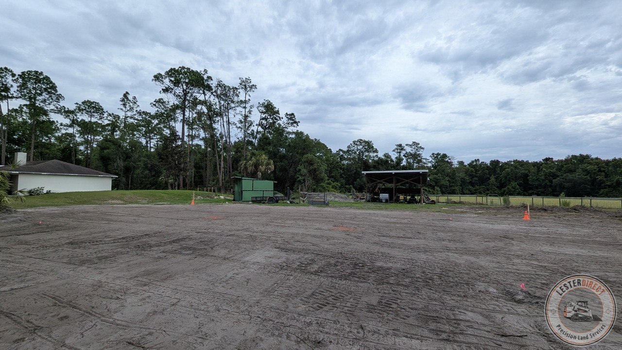
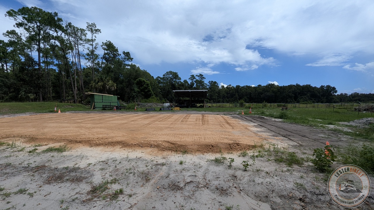
A curated collection of verified field execution across active site preparation, laser-guided grading, structural lift placement, and site protection controls.
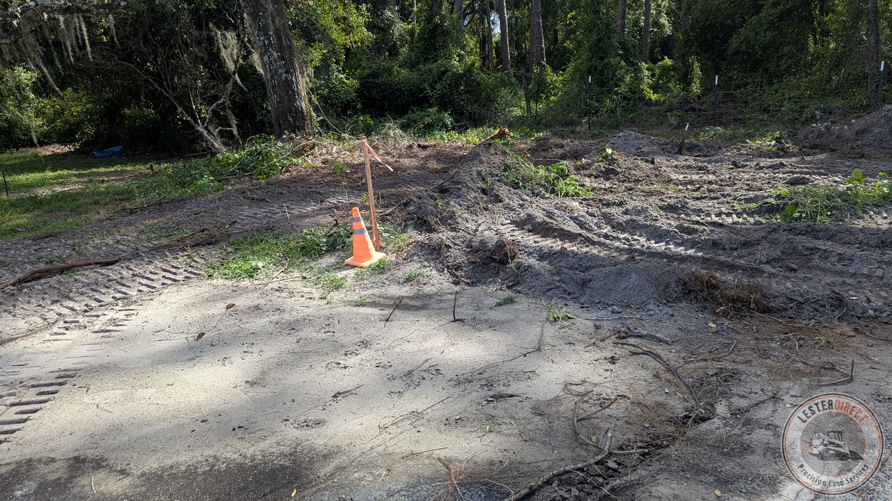
Expanding perimeter clearance at the south-west boundary to establish uninhibited swale flow lines.
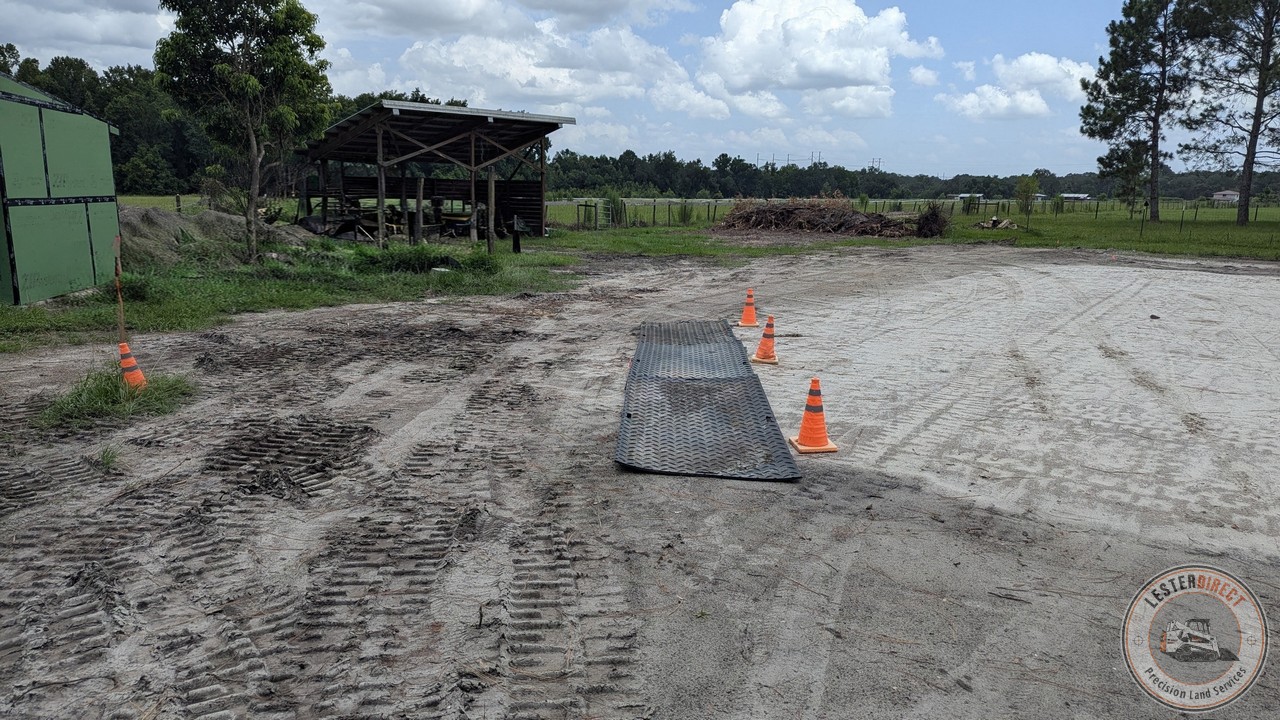
Ground protection matting and traffic controls pre-staged for heavy debris haul-off along the north-east perimeter.
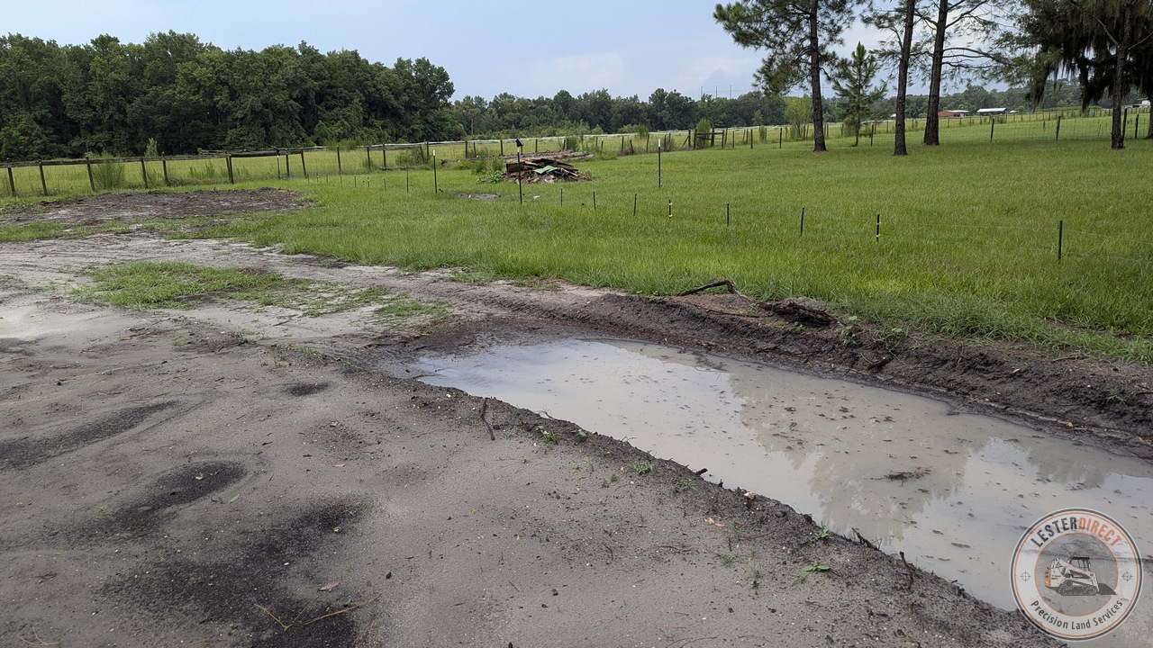
Active storm runoff conveyance along the south perimeter swale, directing surface water clear of the pad subgrade.
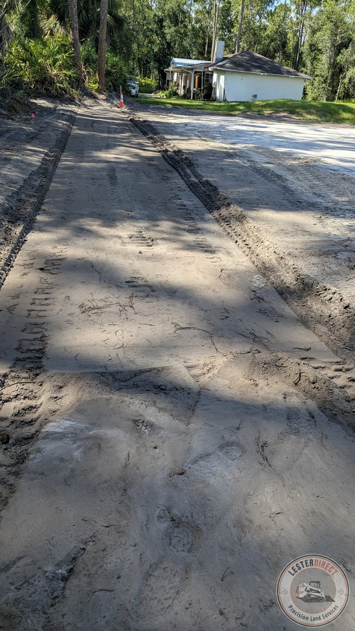
Cleanly carved 1.0% west relief swale designed to sheet precipitation away from structural pad envelopes.
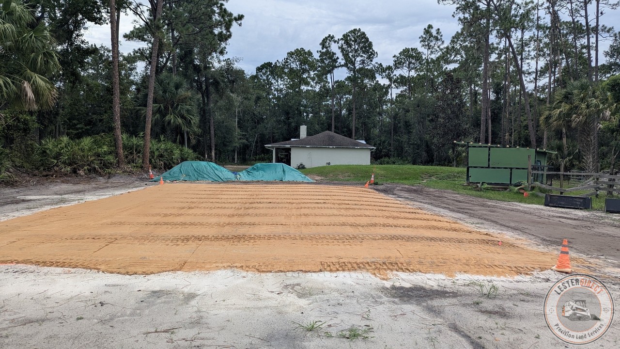
Compacted 4"–5" clay-sand lift placement across the main pad core, for maximum structural density.
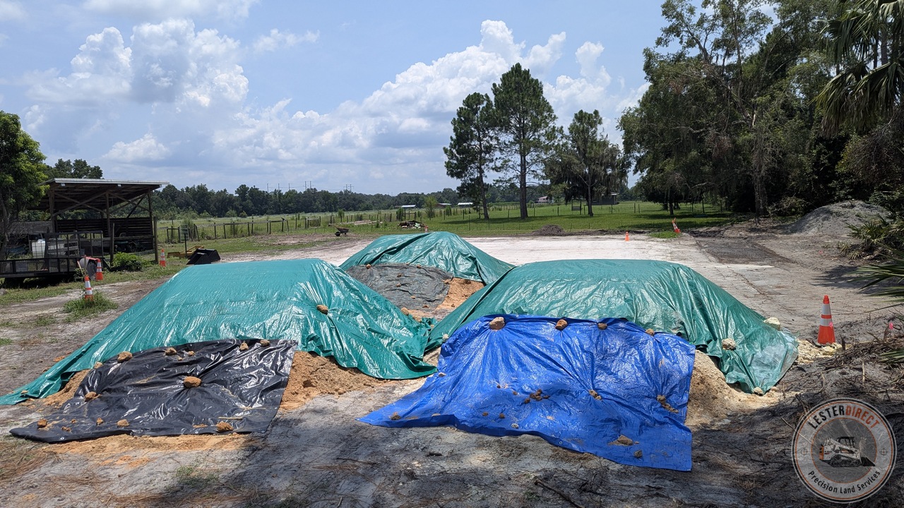
Pre-staged clay-sand aggregate secured under weighted double tarps to defend optimum moisture content prior to placement.
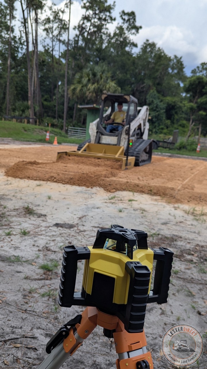
Rotary laser transmitter referencing benchmark elevation while CTL executes ±0.5" operator-guided grading passes.
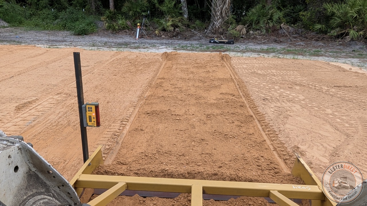
Operator cab view of off-pad laser transmitter alignment during active clay-sand lift spreading.
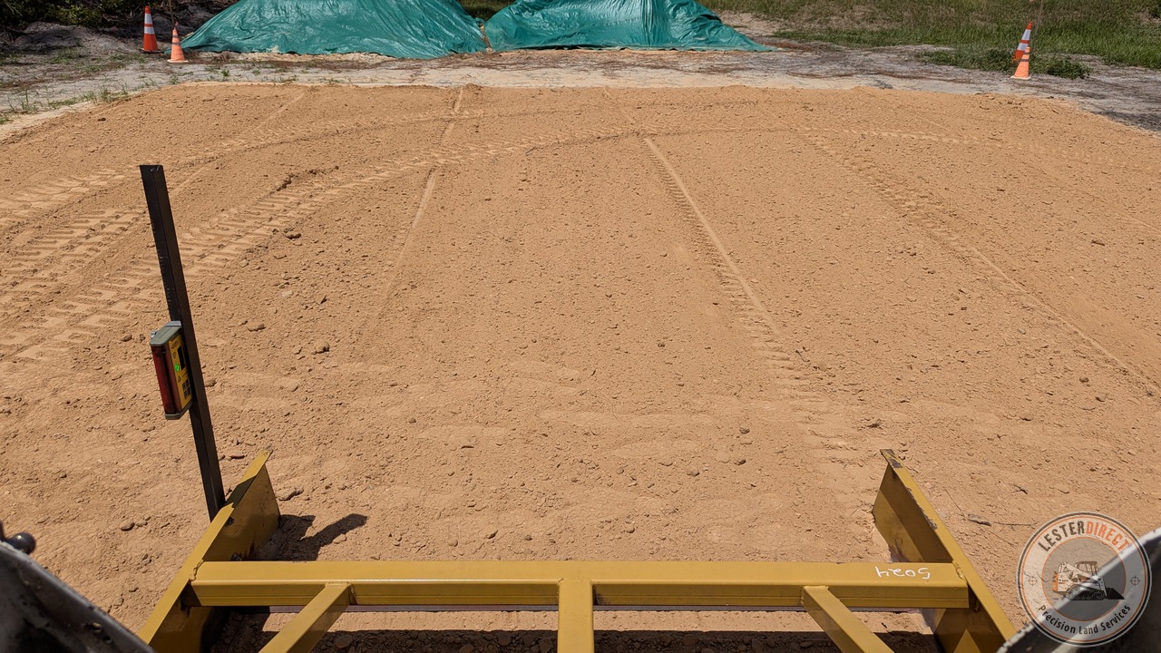
Active laser receiver lock verifying ±0.5" grade tolerance during north-south pad leveling.
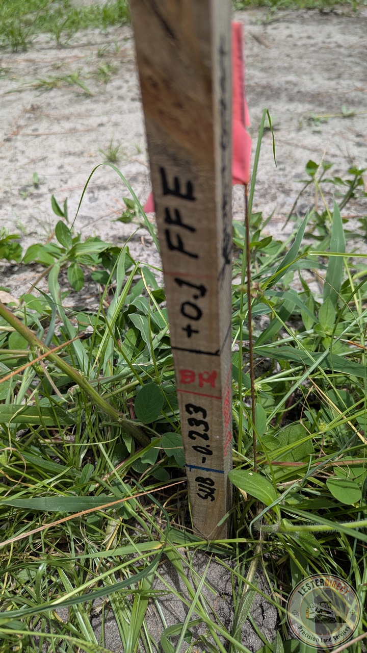
Permanent site control hub stake defining Finish Floor Elevation (FFE), benchmark datum, and subgrade fill targets.
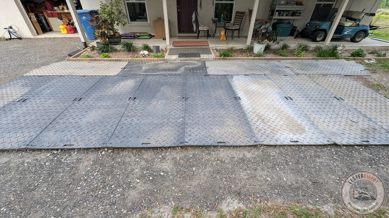
Heavy-duty ground mats deployed over paver surfaces to eliminate rutting and protect client hardscapes during heavy truck haulage.
When you hire a tractor by the hour, you are often paying for the "guess and bulldoze" method. At LesterDirect, we bring civil-grade site integration to residential & commercial properties.
With a technical, process-driven approach, we design for the 'why'—ensuring your development is structurally sound. Using advanced 3D topographical mapping, we digitally map your site to the inch. We take things like lateral cross-slopes, water diversion, and soil compaction into consideration before the heavy equipment even fires up—so your project is built with precision to last.
Ready to discuss your project? Give us a call or send a message. We're happy to discuss your needs and provide a no-obligation estimate.
Call or Text: (386) 227-7199
Email: pls@LesterDirect.com
Service Area: DeLand, Volusia County, and surrounding Central Florida areas.